Creating a new RSMS Network
This document will show how to create a new river basin for RSMS. Each river basin will consist of a mainstem and the tributaries the feed into the mainstem. You will need a HEC_RAS .pri file for the river basin that you are modeling.
What we need from the Client
HEC-RAS .prj file for the river basin.
What needs to be created
River Basin Database consisting of the following tables.
- RiverLatLong
- HEC_RASFlow
- HEC_RASFilesProcessed
- RivermileIndex
- RiversXref -(USGS Reference)
- RSMSRiver - (River with IENC River Code)
RMI File - (River Mile Index file)
Create River Basin
Open 5.0.3 version of HEC_RAS
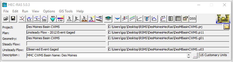
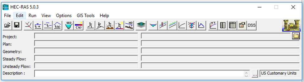 Open your .prj file
 Click on GIS Tools then click on RAS Mapper
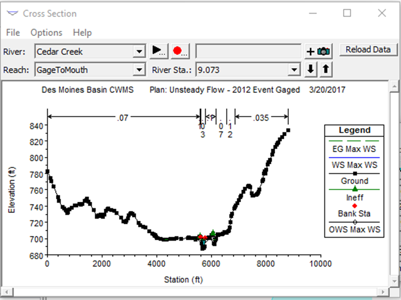
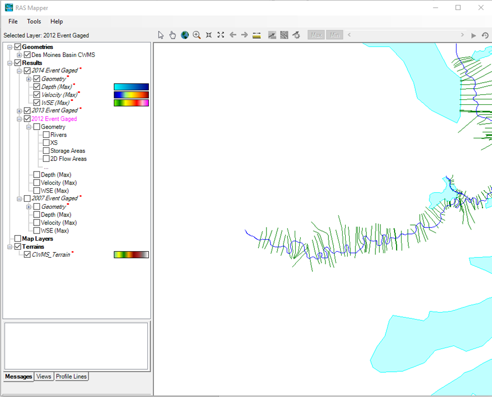 Then click on View Cross Sections
Construct the RMI Table
The RMI table needs the following columns.
- ID – A number starting at 1 and just a count of numbers in the RMI table. ID numbers are unique.
- MRM – Stands for the Mainstem River mile.
- TRM – Stands for the Tributary River Mile.
- UDIntCode – Unique ID code. This is a number starting at 1 that denotes the order of the Rivers. It starts with the Mainstem and then when Mainstem has been finished the first tributary is written in. This means when adding a new tributary you need to find the correct locations for the tributary to enter on.
- River – HEC_RAS name for the river.
- Reach – HEC_RAS name for the Reach.
- Nearest River Station – It will be the closest river station mile in HEC_RAS. It does not differentiate between Mainstem or Tributary.
Mainstem
Go to the cross sections window that you should have open.
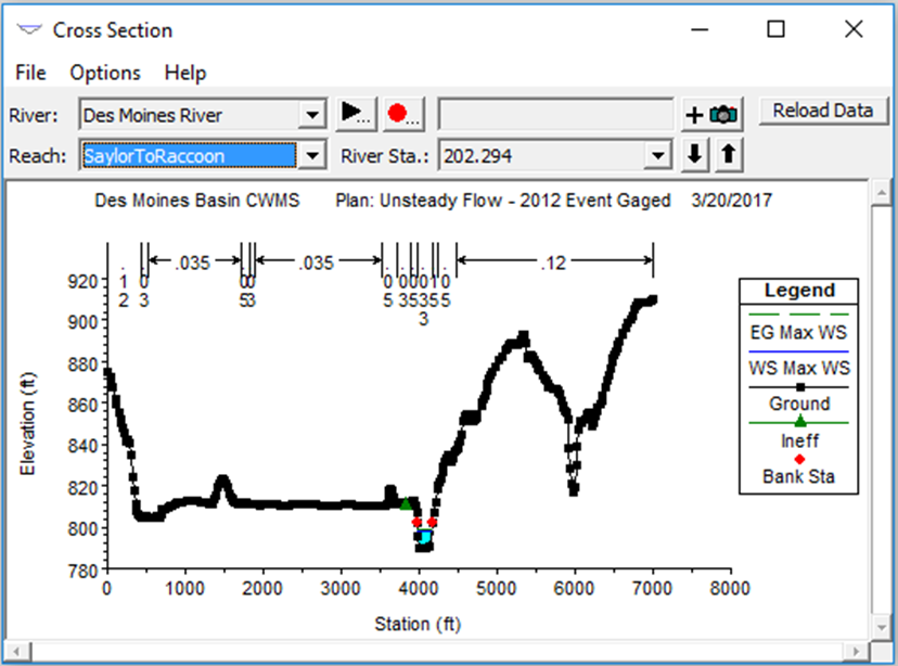
- Pick your river in this case it should be Des Moines River.
- Go to the Reach and pick the first reach. In this case it is SalyorToRaccoon
- Look at the river Station. In this case it is 202.294
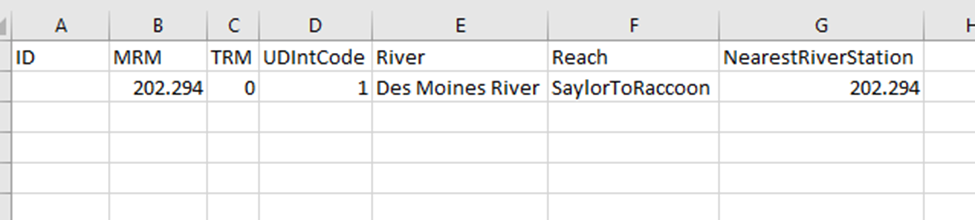
- You now have everything you need to fill out the Mainstem RMI. I recommend that you put this into an excel sheet until the riverbasin is complete with tributary.
- Your ID should be the number of entries starting at 1. If you are doing this in an excel sheet leave this column blank until you finish the complete river basin.
- MRM is the River station.
- TRM is zero because this is the mainstem.
- UDIntCode is an interger that starts at 1 and increacess by 1 at each entry in the river station. Please note that if you have any tributaries in your river basin the UDIntCode will be different that the ID.
- River will be Des Moines River
- Reach will Be SalyorToRaccoon
- Nearest River Station will be the same as the MRM.
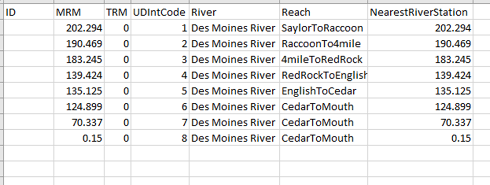
 Go to the next station and continue this process. In this case we are only using 1 station per reach until the las reach where we use 3 because it is so long.
Tributary
Go to the cross sections window that you should have open.
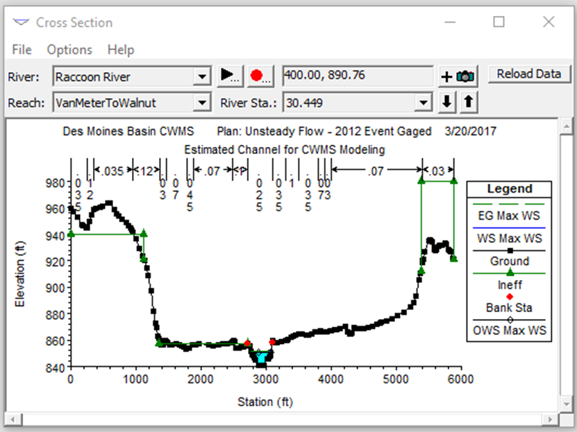
Pick your river in this case it should be Raccoon river.
Go to the Reach and pick the first reach. In this case it is VanMeterToWalnut
Get the River Station. In this case it is 30.449
You will need to look at the RAS Mapper window and find your tributary on the map.
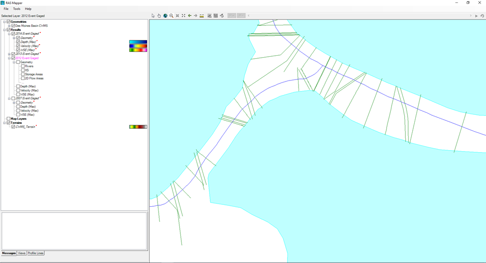 You will need to approximate where the tributary is coming in on the Des Moines river. That will be your Mainstem River Mile. Since the two closet river stations are 190.554 and 190.469 somewhere between that is what I needed so I chose 190.3
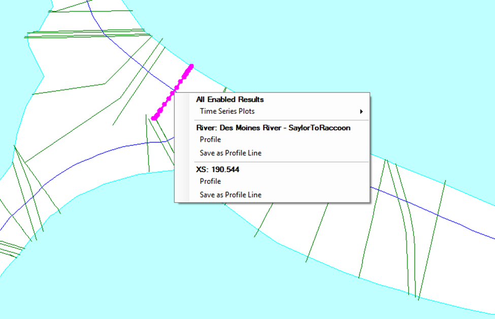
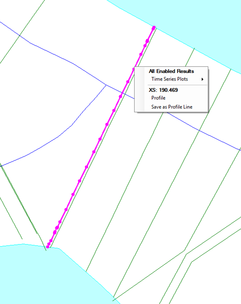 Go back to your spread sheet.
Insert a new line for the tributary between the river stations upstream and downstream of the Tributary in this case between 109.469 and 183.245
Go back to your spread sheet.
Insert a new line for the tributary between the river stations upstream and downstream of the Tributary in this case between 109.469 and 183.245
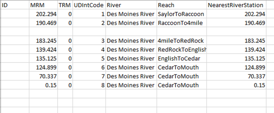 ID will be done later.
MRM is where the tributary is coming into the Mainstem. (This is the information you got from RAS Mapper.) In this case 190.3
TRM is the River station. In this case 30.449
UDIntCode continue the count from the end Mainstem or the Last Tributary. Please keep in mind you want to add the tributaries in the order they appear going into the mainstem from the tributary to the source. In this case it will be 9.
River will be Raccoon River.
Reach will Be VanMeterToWalnut
Nearest River Station will be the same as the TRM 30.449.
ID will be done later.
MRM is where the tributary is coming into the Mainstem. (This is the information you got from RAS Mapper.) In this case 190.3
TRM is the River station. In this case 30.449
UDIntCode continue the count from the end Mainstem or the Last Tributary. Please keep in mind you want to add the tributaries in the order they appear going into the mainstem from the tributary to the source. In this case it will be 9.
River will be Raccoon River.
Reach will Be VanMeterToWalnut
Nearest River Station will be the same as the TRM 30.449.
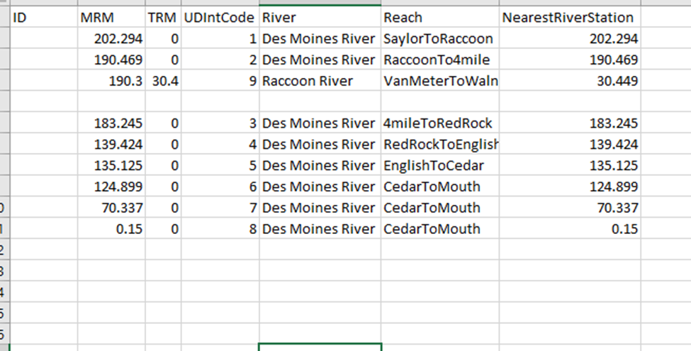 Go to the next river station and continue this process.
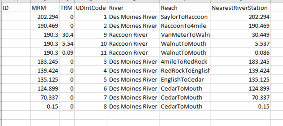
When your river basin has been completed fill in the ID with a strait count from your excel sheet.
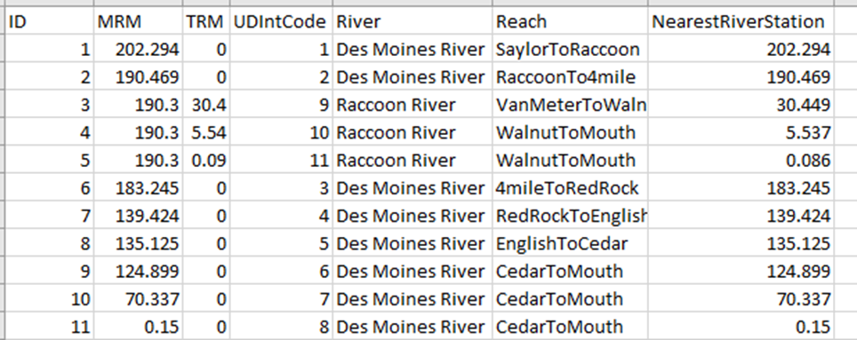 Save the excel into a CSV file and import the data into the Database.
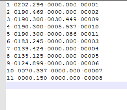 Constructing the RMI file.
Copy the data from the RMI table into a notepad++ file.
The format should be ID, RMR, TRM, UDIntCode
Add the zeros so that your data matches the format shown below.
Constructing the RMI file.
Copy the data from the RMI table into a notepad++ file.
The format should be ID, RMR, TRM, UDIntCode
Add the zeros so that your data matches the format shown below.
Save the notepad as an .RMI file.
Construct the Lat Long Table
The RiverLatLong table needs the following columns.
- ID – A number starting at 1 and just a count of numbers in the RMI table. ID numbers are unique.
- River – HEC_RAS name for the river.
- RiverMile – It is the river station mile in HEC_RAS. It does not differentiate between Mainstem or Tributary.
- Latitude – Latitude for the River Station
- Longitude – Longitude for the River Station
Use the same excel that you created the RMI file from. Create a new page.
Copy over the following columns. Id and River from RMI page. Copy over the Nearest River Station and put it under the River Mile page.
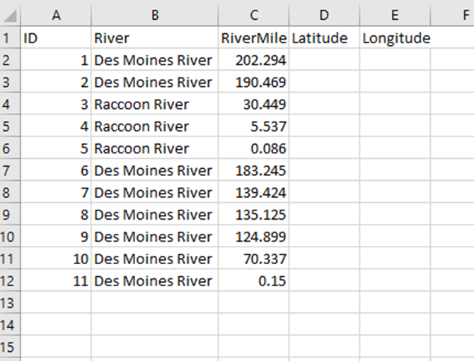 Please note that the ID in this table does not need to be the same as the one in Rivermile index but for convenience we will be copying it over.
To get the River Stations lat and Long you will need to open up Google Maps. Type in your river. Then Go to HEC_RAS Ras Mapper Find your river Station on the map.
Please note that the ID in this table does not need to be the same as the one in Rivermile index but for convenience we will be copying it over.
To get the River Stations lat and Long you will need to open up Google Maps. Type in your river. Then Go to HEC_RAS Ras Mapper Find your river Station on the map.
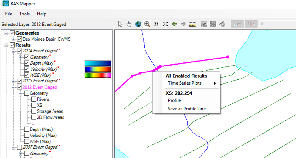
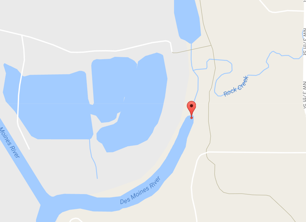
Find the same location on google maps as in HEC_RAS (use the shape of the river to find the locations.)
Put a pushpin at that location. This will give you the Lat and Long for the pushpin. Copy and paste them into the Lat Long page of your excel sheet.

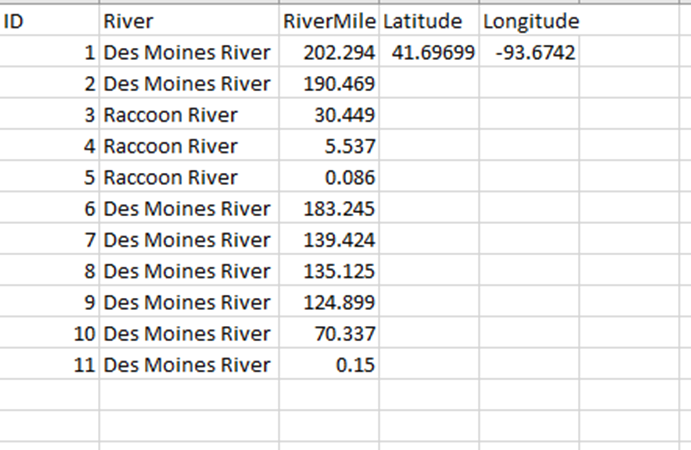
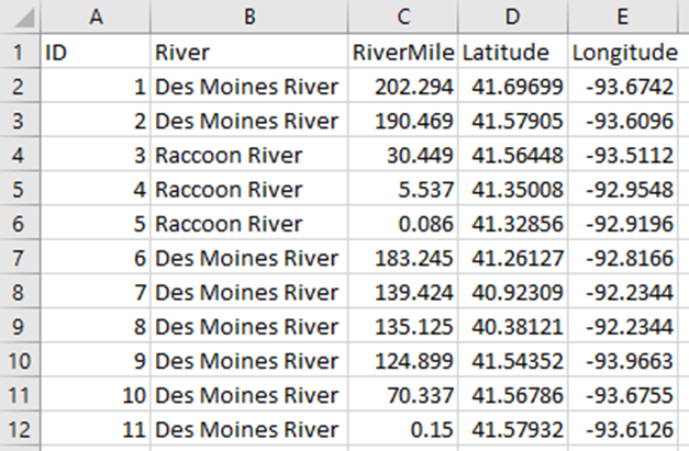 When you are finished with all the Lat Longs save the file to CSV and import it into the Database.
Modify the Config File The following are changes that you will need to make to the config file in order for the program to Run.
- Database connection strings
- There are 5 databases referenced in this program. They will all need to be modified so that they point to the right database Engine.
- DefaultConnection
- SpillModels
- ScenarioModels
- RiverBasinModels
- USGSModels
- There are 5 databases referenced in this program. They will all need to be modified so that they point to the right database Engine.

- Mainstem perimeter
- RMI file
- App Path
- RMI Path