Running Chama with new Rainfall
We have received the Rainfall files for Chama from Caleb November 9th 2023. The link to this is EPA Sharepoint Rainfall Files.
We have noticed that the rainfall span of the events are long. They are not necessarily clustered around a specific event. The image below is from 2011Aug07T05 file.
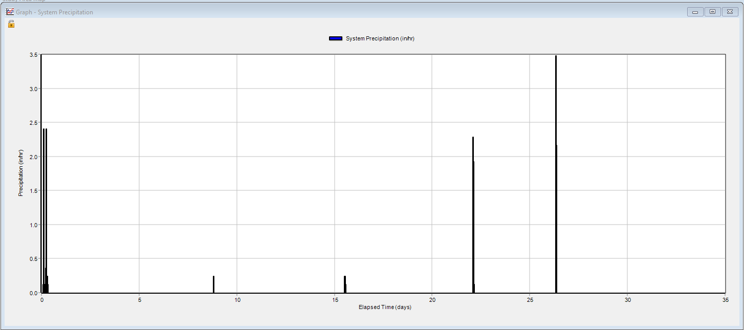 This is a month of data the simulation starts on 7/8 and ends on 8/7.
This does cause the runs to take longer in SWMM5 UI the Total elapsed time: 00:28:23.
This is a month of data the simulation starts on 7/8 and ends on 8/7.
This does cause the runs to take longer in SWMM5 UI the Total elapsed time: 00:28:23.
After looking at the Event files there is a list of Events. This has a start and end date associated with it. These dates are not the same as the .dat files.

INP file Changes
There have been some changes between GQC's Copy of the INP file and the one that Caleb sent back with the Rainfall Files.
For this section the red is Caleb's INP and the Green is our INP.
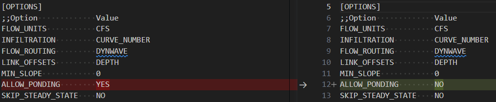
- Allowing Ponding - Normally in flow routing, when the flow into a junction exceeds the capacity of the system to transport it further downstream, the excess volume overflows the system and is lost. An option exists to have instead the excess volume be stored atop the junction, in a ponded fashion, and be reintroduced into the system as capacity permits. This amount of surface area is an input parameter supplied for the junction.
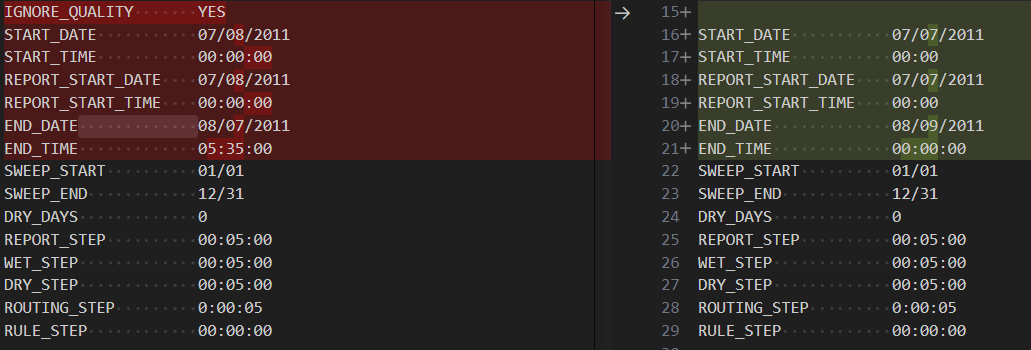
- Ignore_Quality - is set to YES if pollutant washoff, routing, and treatment should be ignored in a project that has pollutants defined. The default is NO.
- Slightly different start and end times for the simulation. His simulation is from 7/8/2011 at midnight to 8/7/2011 at 5:35 am where as our simulation is 7/7/2011 at midnight to 8/9/2011 at midnight. The dates are based on the dates in the Rainfall file.
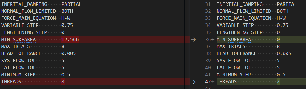
- MIN_SURFAREA - is a minimum surface area used at nodes when computing changes in water depth under dynamic wave routing. If 0 is entered, then the default value of 12.566 ft2 (i.e., the area of a 4-ft diameter manhole) is used.
- THREADS - is the number of parallel computing threads to use for dynamic wave flow routing on machines equipped with multi-core processors. The default is 1.


- Rain Gages and Timeseries - this is a change to the way we are doing the rain gages instead of using the rain gage section to call the rainfall.dat file we will be using the rain gage section to reference a time series section that will refer to a rainfall.dat file. This stops swmm from having issues with the finding the rainfall.dat file.

- Report Input - Check this option if you want the simulation's Status Report to list a summary of the project's input data.

- Map Units - We want to keep with Feet. We do not want to change to Metric.
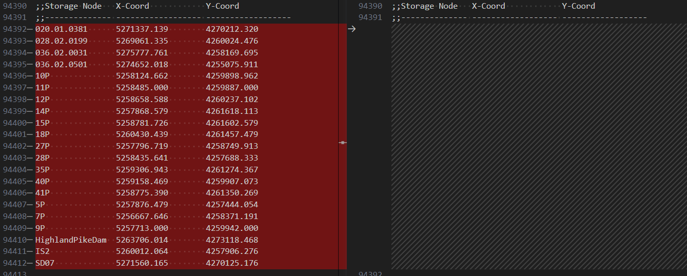
- Storage Nodes in X-Coord and Y-Coord
- We have not been using storage nodes.

- Rain Gage Symbol - This is something we added in it is not required but it allows the user to view the Rain gage information in the Map of the SWMM UI program.